
Protecting Communities Against Forest Fires

Under the Community Wildfire Protection Plans (CWPP) and the Strategic Wildfire Prevention Initiative (SWPI), Evan was commissioned by the Slocan Integral Forestry Co-operative (SIFCo) to develop the mapping components of their CWPP and design complex data workflows.
Through this project, an opportunity was identified to automate the Wildland-Urban Interface (WUI) threat analysis, which traditionally relies on in-field assessments of critical infrastructure based on topography, structure location, and forest management practices. By leveraging remote sensing and advanced scripting, an automated process was developed to evaluate these variables and assign risk scores with the precision of manual assessments. This approach efficiently analyzed 200 pieces of critical infrastructure, pinpointing forest areas at the highest wildfire risk and delivering actionable insights for wildfire mitigation strategies.
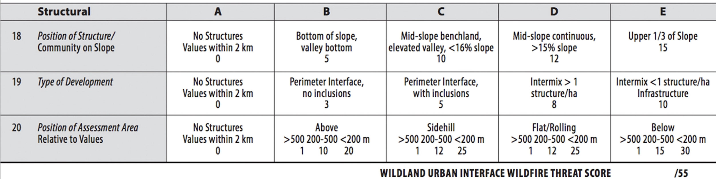
Example of an in-field WUI Analysis table