Expertly Crafting Custom GIS Data Flows, Geospatial Analyses, and Remote Sensing Solutions
Our Services

Remote Sensing
Geodesic Solutions specializes in utilizing advanced remote sensing technologies, including LiDAR data and Earth observation satellite imagery, to provide detailed environmental mapping and analysis. Our remote sensing services are crucial for understanding and managing ecosystems. By providing in-depth insights into ecosystems and land use, we empower our clients to make informed decisions that drive sustainable environmental management.

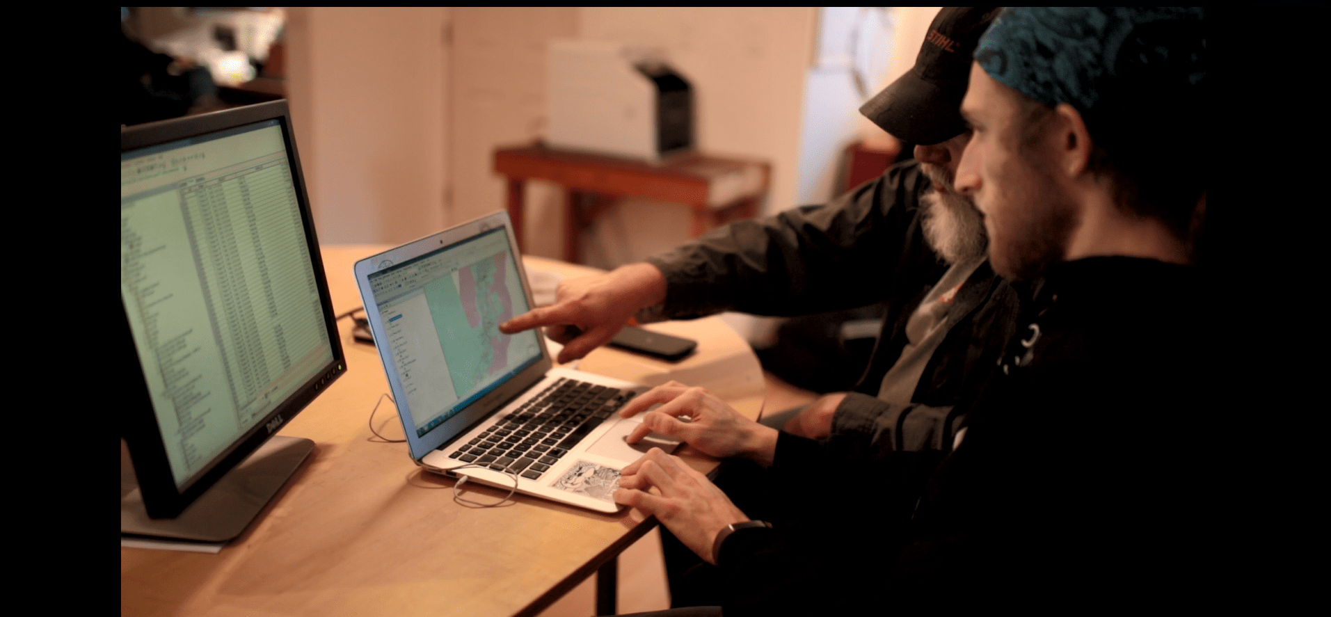
Cartography and GIS Analysis
At Geodesic Solutions, we combine expert cartographic design with creative flair to produce maps that are both informative and visually striking. Our GIS analysis services transform complex spatial data into clear, actionable insights, with a focus on ensuring that our maps not only meet project needs but also align with your brand's aesthetic and messaging. We tailor each design to enhance communication, decision-making, and visual impact.
Predictive Modelling
Our predictive modelling services are designed to identify wetlands and other land types using machine learning classifiers integrated with LiDAR, imagery and ground truthing data. These models help identify and protect vital wetland areas, offering crucial insights for conservation planning and climate resilience. Geodesic Solutions delivers actionable predictions that support effective policy-making and resource management in sensitive ecosystems.
Data Analysis & Integrations
Geodesic Solutions excels in data analysis and cross-platform integration, using APIs to seamlessly connect diverse data sources. We specialize in data manipulation, standardization, and data transfer between systems, ensuring that your data is accessible, accurate, and optimized for use across various platforms. Our approach enables efficient data flows and enhances the functionality of your applications, driving better outcomes for your projects.
Software Expertise:
The list below highlights softwares we regularly use and have integrated across platforms using automated API approaches


"Geodesic Solutions helped me build the base maps for my hiking guidebook, sourcing public data and helping me style it in a clear, accessible way. They also provided constructive critiques of my topographic map design to align with best practices. They delivered everything in one business day (!) and within my budget. Geodesic Solutions was a pleasure to work with and I hope we can collaborate in the future."
— - Abby Wilson, West Kootenay Hiking Editor
