-
![]()
Predictive Wetlands
Our wetland predictive model integrates geospatial data, environmental variables, and advanced analytics to forecast where wetlands are most likely to occur across landscapes. This system helps identify hidden or vulnerable wetland areas, supporting conservation planning, land management, and climate resilience.
-
![]()
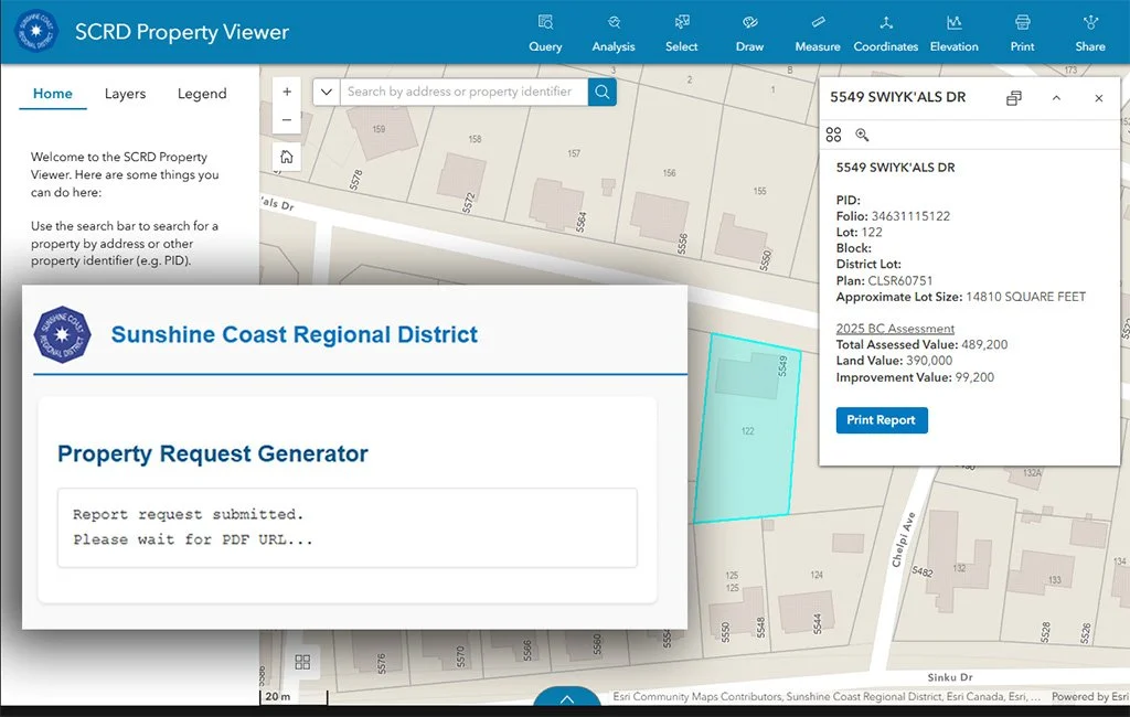
SCRD's Custom GIS Web Tool
We developed a custom web application for the Sunshine Coast Regional District that makes parcel information easy to access. Through a simple online interface, users can generate detailed PDF property reports that combines data and maps into a single document—streamlining access to information for planning and decision-making.
-
![]()
Data Insights for Wildlife Protection
The Valhalla Wilderness Society needed a data-driven look at how forestry impacts sensitive caribou habitat. We delivered clear maps and summaries that revealed changes over time and highlighted areas under pressure. The results equipped VWS with the evidence to guide policy, strengthen advocacy, and raise awareness around caribou protection.
-
![]()
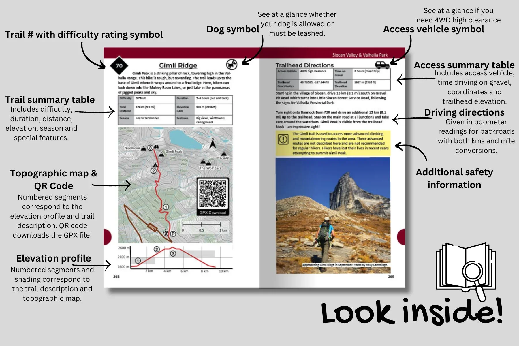
West Kootenay Hiking Guide Book
For the 2nd edition of the West Kootenay Hiking Guide, we supported the author in elevating the map quality with professional cartography. By leveraging provincial datasets, we designed a detailed basemap, topographic shading to convey terrain, and labeled contours to improve readability.
-
![]()
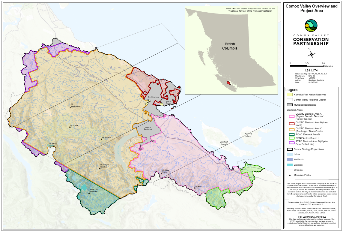
Cartography Driving Policy Changes
Through the Nature Without Borders project in the Comox Valley, we developed maps that translated ecological data into clear visuals for decision-makers. By highlighting sensitive ecosystems and their vulnerabilities, these maps became tools for shaping policy discussions and supporting more sustainable land-use planning.
-
![]()
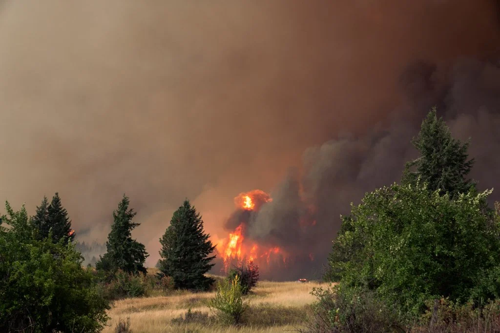
Protecting Communities Against Wildfires
Using remote sensing and automated data workflows, we’ve developed a system to assess wildfire risk across the Wildland-Urban Interface (WUI). This approach streamlines traditional field-based assessments, delivering fast, accurate insights that help communities protect infrastructure and plan effective mitigation strategies.
-
![]()
Revamping The Waste Industry
At ReCollect, we worked with municipalities and haulers to integrate GIS data into a single platform. By automating cross-platform processes, workflows became more efficient and data moved more smoothly between systems. This approach supported cleaner datasets, faster updates, and more reliable information for both staff and customers.