
Custom Web Tool for the Sunshine Coast Regional District
The Sunshine Coast Regional District (SCRD) needed a way to provide clear, accessible property information to staff, decision-makers, and the public. Traditionally, generating parcel-specific reports utilized an outdated Geocortex system. Our goal was to streamline this process into a single, easy-to-use tool.
Building a User-Friendly Solution
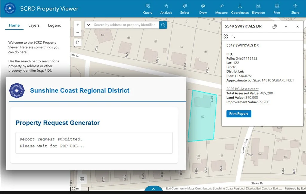
To meet this need, we developed a custom web application using ArcGIS Experience Builder. The tool was designed with simplicity in mind: users can select a parcel of interest through an interactive map and instantly generate a PDF property report.
Behind the Scenes
Although the user experience is straightforward, the system is powered by a layered workflow that integrates multiple technologies. When a parcel is selected, the application triggers a geoprocessing service hosted on ArcGIS Server. From there, a sequence of automated processes—including monitoring scripts and Python-based geoprocessing—collects the relevant datasets and compiles them into a formatted PDF.
Delivering Value
The end result is a report that combines mapping, data, and analysis into a single document. For staff, this saves time and ensures consistency across reports. For the public, it provides a clear and accessible way to understand property information without navigating complex datasets.
A Model for Accessible GIS
The SCRD property report tool demonstrates how GIS, automation, and thoughtful web design can come together to simplify access to information. The district now has a system that is efficient, reliable, and easy to use—helping both staff and the community make informed decisions.