
Supporting Local Adventure with Professional Cartography
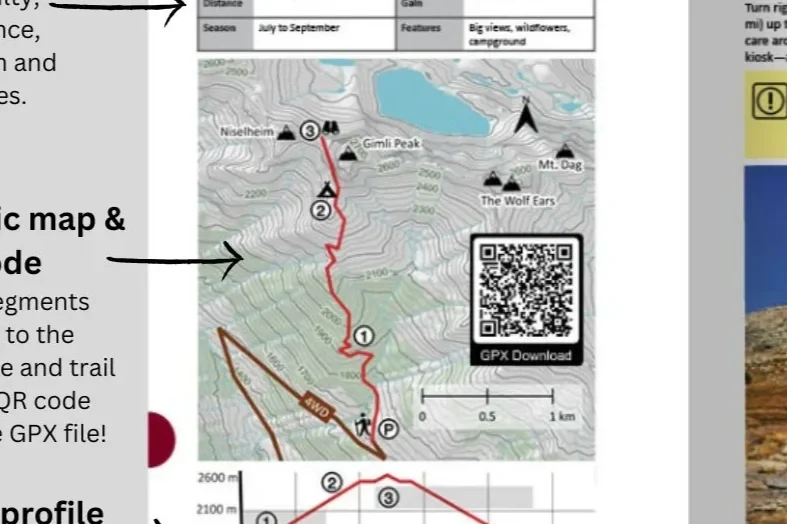
The West Kootenay Hiking Guidebook was preparing its second edition, taking on the challenge of map-making with limited resources and technical experience. Open-source basemaps were initially used, but they lacked the detail and customization needed for a high-quality guide—often missing accurate vegetation distinctions, nuanced terrain features, and clear labeling of contours.
To enhance the guide, we collaborated with the author to provide cartographic recommendations and design support. Using provincial datasets such as vegetation coverage, the Freshwater Atlas, and other open data sources, we built a basemap that clearly differentiated vegetated zones from alpine areas. Topographic shading was applied to convey terrain depth, and contours were labeled with consistent line thicknesses at key elevation intervals to improve legibility and understanding of the landscape.
Our goal was to make maps that are both functional and visually appealing, giving hikers an intuitive understanding of the landscape while maintaining the guide’s aesthetic style. Beyond the technical work, this project allowed us to support a local author and small business, contributing to the West Kootenay community and encouraging exploration of the region’s trails.
The result is a map system that blends professional design, accurate geospatial data, and a love for the local landscape—helping adventurers navigate safely and confidently.